Current Sonoma County
Parklands Compiled by the Coalition for the Outdoor Recreation Plan (CORP), June 1999
* Hood Mtn. Park (1452 acres) arguably should be classified as a preserve, which implies limited access, rather than as Regional Open Space Park (Passive), as it is currently closed half the year. [CORP ed.] Here is some of the above information in graphical form. First parklands in Sonoma County by Parks and Rec planning areas ("all parks" includes state parks):
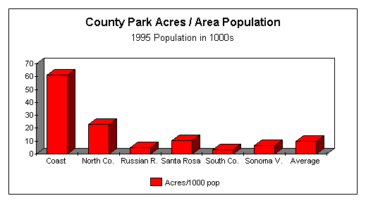
Unlike the five supervisorial districts, the six Parks & Rec planning areas vary widely in population from 8,100 in Area 1 (Sonoma Coast) to 169,900 (Santa Rosa and East), using 1995 population numbers. Parkland adequacy is often calculated using acres/population in 1000s. The following chart compares regions using this metric on county parklands alone:
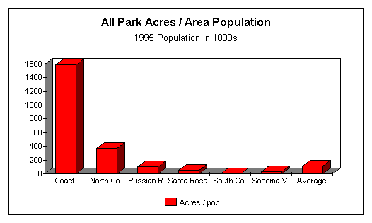
And, finally, the same comparison but with all park acres (county plus state):
|